-Jg:正交投影
正交方位投影是一種從無窮遠距離處的透視投影,因而常用於繪製從外太空看地球。與Lambert等面積投影以及立體投影類似,一次只能看到一個半球。該投影既不是等面積也不是保角,在半球邊界處有較大得畸變。從投影中心出發的任意方向是真實的。
該投影的參數爲:
-JGlon/lat[/distance]/width 或 -Jglon/lat[/distance]/scale
- lon/lat 是投影中心位置
- distance 是邊界離投影中心的度數,默認值爲90
- scale 地圖比例尺 1:xxxx 或 radius/latitude (radius 是緯線 latitude 與投影中心在圖上的距離)
gmt coast -Rg -JG-75/41/4.5i -Bg -Dc -A5000 -Gpink -Sthistle -png GMT_orthographic
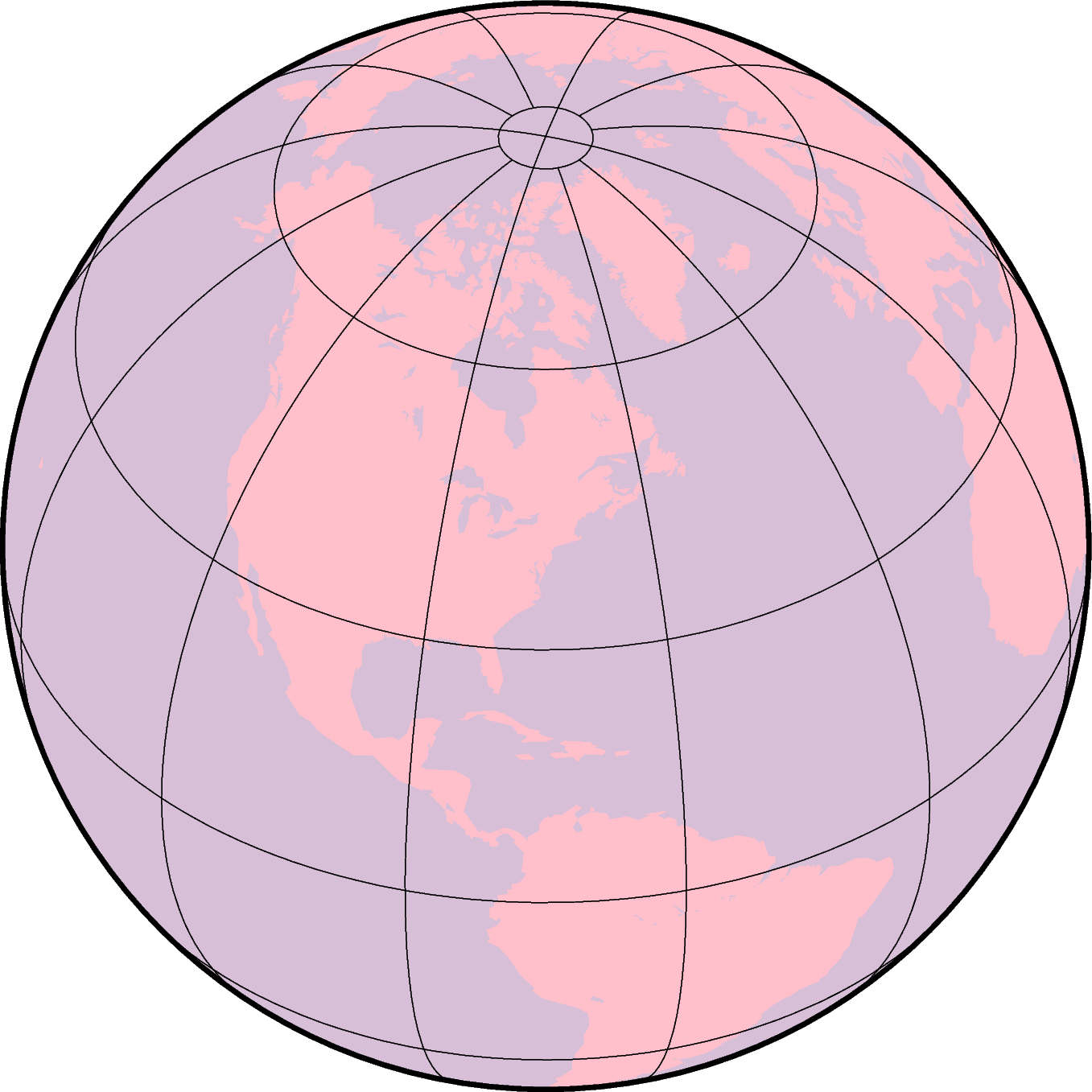
使用正交投影繪製半球
-Jg 加上更多的參數時還可以用於繪製透視投影,以在二維平面內模擬從太空看三維的地球。具體的參數爲:
-JGlon/lat/alt/az/tilt/twist/width/height
- lon/lat 投影中心的經緯度
- alt 是觀察者所處的海拔,單位爲km。若該值小於10,則假定是觀察者相對於地心的距離,若距離後加了 r,則表示觀察者與地心的距離(單位爲km)。
- az 觀察者的方位角,默認值爲90度,即從東向觀測
- tilt 傾角(單位爲度),默認值爲60度。若值爲0則表示在頂點直接向下看,值爲60則表示在頂點處沿着水平方向30度角的方向觀察
- twist 扭轉角度,默認值爲180度。This is the boresight rotation (clockwise) of the image. The twist of 180° in the example mimics the fact that the Space Shuttle flies upside down.
- width/height 是視角的角度,單位爲度,默認值爲60。This number depends on whether you are looking with the naked eye (in which case you view is about 60° wide), or with binoculars, for example.
- scale as 1:xxxxx or as radius/latitude where radius is distance on map in inches from projection center to a particular oblique latitude
gmt coast -Rg -JG4/52/230/90/60/180/60/60/5i -Bx2g2 -By1g1 -Ia -Di -Glightbrown \
            -Wthinnest -Slightblue --MAP_ANNOT_MIN_SPACING=0.25i -png GMT_perspective
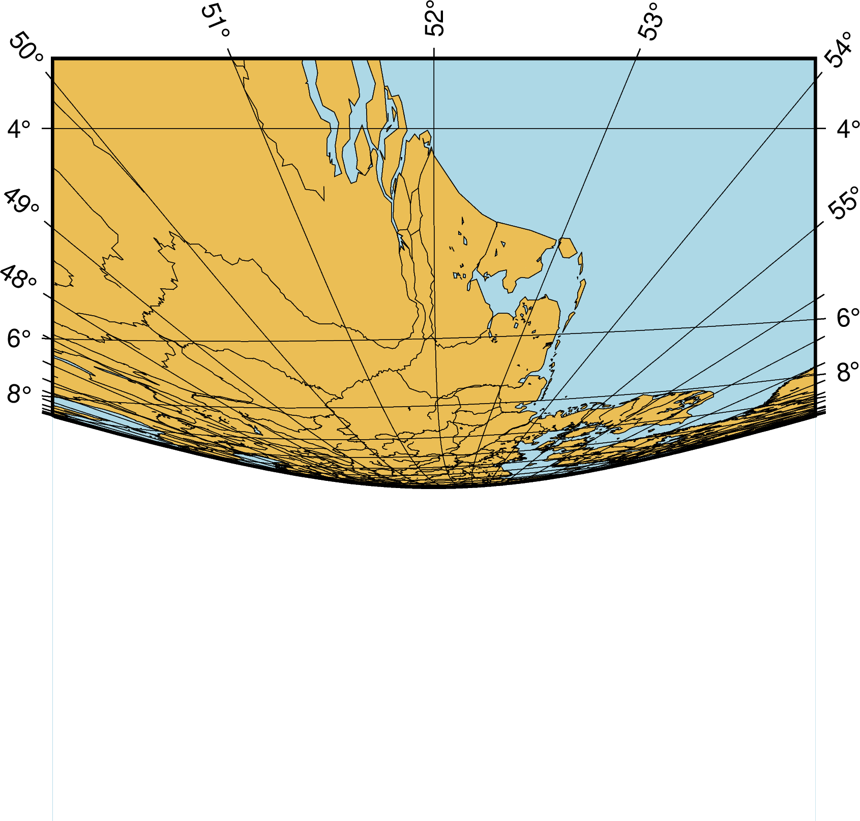
透視投影